Showing posts with label London. Show all posts

Tuesday, 28 August 2012

Mappy Monday - London institutions 1911

Leaving the workhouse 1883
As part of the day job, I have been looking at the census statistics for institutions such as workhouses, barracks, prisons and so on. As I looked though the tables of the 1911 Census Report, it struck me that several London institutions were not in London at all, but in the adjacent counties. Even withing London, some were outside the actual parishes to which they belonged. For example, the St George Hanover Square workhouse was in Fulham.

The reason for this is obvious, when you think about it. London was full. From the early 19th century, if a London parish needed to build a workhouse, or even bury its dead, there was no space in the centre of town, so they had to look for available land further afield. As London grew, and with it the demand for workhouses, hospitals and more, these institutions were built further and further afield.

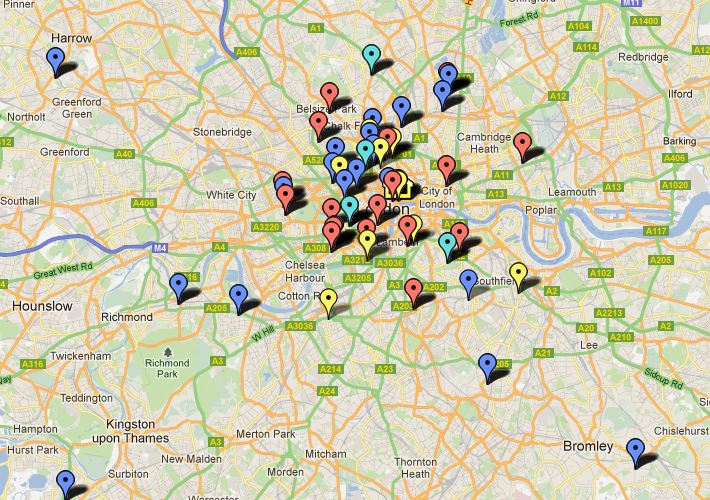
I decided to plot the positions of the London institutions that were outside London altogether, using Google Maps and the results were rather interesting. I also colour-coded them, red for workhouses and homes, dark blue for schools, light blue for asylums and green for hospitals and convalescent homes. I also added some details about each one, including the number of staff and inmates. The locations are approximate, although I may be able to refine them as I find out more about each of them. Meanwhile, they give a reasonable indication of how far London habitually removed some of its poor and needy.

Furthest afield are sanatoria and convalescent homes, some of them is seaside resorts, but by far the greatest number of displaced Londoners were in asylums. Nowadays we would call them mental hospitals, but in 1911 terms like 'Lunatic Asylum' were considered perfectly acceptable; Several of them had more than 2000 inmates.

'London' in this case is the Administrative County of London, created with the formation of the London County Council in 1888. It comprised the Mettropolitan Boroughs of Battersea, Bermondsey, Bethnal Green, Camberwell, Chelsea, Deptford, Finsbury, Fulham, Greenwich, Hackney, Hammersmith, Hampstead, Holborn, Islington, Kensington, Lambeth, Lewisham, Paddington, Poplar, St Marylebone, St Pancras, Shoreditch, Southwark, Stepney, Stoke Newington, Wandsworth, Westminster Woolwich and the City of London.

This 1896 map gives some idea of the area covered, although it also includes parliamentary constituencies, which have slightly different boundaries - the main difference being that West Ham is not part of the London County Council area. 

So you may find that members of your family you have always considered to be Londoners are a long way from home on census night. Most, though not all, of these places were Poor Law institutions of some kind, so the place to look for more information and links is of course Peter Higginbotham's The Workhouse site. Many related records will be found at the London Metropolitan Archives, and some are even online at Ancestry.co.uk

Print

Saturday, 25 August 2012

Shopping Saturday - Oetzmann & Co


Oetzmann & Co were described in the London Post Office Directory of 1894 as 'complete house furnishers, cabinet makers and upholsterers, British carpet and rug warehouse, importers of Turkey, Persian, Indian and every description of Oriental carpets and rugs' or, according to the 1908 London Telephone Directory 'Cmplt Ho Frnshrs' - and you thought Text-speak was new! Their bill-head, from which the illustration above was taken, claimed that the business was founded in 1848, and it was still in business nearly a century later. You can see a selection of their advertisements on the Grace's Guide site, and one of them is dated 1947.

The founder appears to have been John Robert Augustus Oetzmann, and the business was carried on by his sons after his death in 1886. His brother, Thomas, was a piano-maker, and he too founded a successful business. The family came from Ipswich, and although their surname is German, there is no-one of that name in any English census who was born outside England. It is worth remembering that for centuries East Anglia has had close trading links with the countries that are now Germany and the Netherlands. I thought it was worth including the bill-head from which the top picture was taken, because it includes a comprehensive list of all the goods and services they provided. 


The company advertised extensively in the press, and the example above dates from 1906, when they had evidently taken over another business, Norman & Stacey, or at least acquired their stock. The London Metropolitan Archives holds some records relating to the Oetzmanns, mainly to do with their properties in Hampstead Road. 

Print

Monday, 6 August 2012

Mappy Monday - working at Somerset House


In the census you occasionally come across a description page for an enumeration district like the one above in 1851, which includes a sketch map of the district as well as a list of the streets it contains. I found this one while I was working on one of my pet projects, the story of the people who worked for the General Register Office at Somerset House. 

I have been able to find some of these men in the census, and where I could identify them on a modern map of London I have plotted them using Google Maps. I created a map which I have called General Register Office staff. Each marker represents a member of staff in a particular census year, and its tab shows the man's name, the census year, his address and his post in the GRO at that time.
The markers are also colour-coded 1851  red, 1861 - blue, 1871 - pale blue, 1881 - yellow. It's an ongoing project, so not all census years are included yet, and I also need to do more work to locate some addresses where the street names have changed, or where the streets have disappeared altogether. 

I found the census map particularly interesting because the one of the streets shown, Chapel Street, was the home of the Registrar General at the time, George Graham.  

Print

Saturday, 4 August 2012

London - but not the Olympics this time

Well, I'm catching up on today's Olympic news on TV as I type, but that's the only connection, honest. I've been working on a little piece of research that involves London addresses, and I was using some online resources I thought were worth sharing, including one that was new to me.

May favorite is Lee Jackson's Dictionary of Victorian London, not just because of the excellent content, but because it's FUN. I can also highly recommend his blog The Cat's Meat Shop and following him on Twitter @VictorianLondon is very entertaining.

The site I have only just discovered is the London Miscellany section of map.thehunthouse which is really useful for researching streets, with its very helpful lists of street name changes, and some maps. There are even more good maps at MAPCO and MOTCO.

The Charles Booth Online Archive at the London School of Economics not only has the famous colour-coded Poverty Maps, but also the survey reports and notebooks that go with them. They are particularly good for the East End, but there is plenty of good material for the rest of London, too.

If you want pictures of London back to 1500 (and even more maps) there is the Collage collection from the London Metropolitan Archives and Guildhall Art Gallery.

For printed sources, particularly on the early history of London, there is a large section devoted to London and Middlesex at British History Online

Anyone who lives within easy reach of London, or who visits regularly might want to join London Historians but even if you a long way off there is plenty of interest on the website, and a blog to follow.

And finally, some pictures, because I like to share them.

Billingsgate Market 1841

Clerkenwell Green

Kings College Hospital 1872
London Bridge and Dyers Wharf c1750

Print

Sunday, 6 May 2012

Shopping Saturday - Fortnum and Mason


This seemed like an appropriate choice for 'Shopping Saturday' this week, since the podcast of Selling history: the role of the past at Fortnum and Mason has just gone live on The National Archives website. The talk was given by the company's archivist, Dr Andrea Tanner, who has researched Fortnum's history extensively. Fortnum's is one of several businesses that can claim to be the oldest department store. Their foundation date of 1707 certainly beats all comers with regard to date, but it traded as a high-class grocer for more than three centuries, only adding clothing and household departments in 1925.

Of course, the first this the genealogist wants to know is 'Are there any staff records?', and, sadly, the answer is no. This is not particularly unusual, as you may already know if you have ancestors who worked in the retail trade; it is much easier to find out about the kind of work they did than the details of any individual person's service. But shops and shopping have always been a part of everyday life for everyone, or at least for someone in their family, so we all have some connection with shops. Realistically more of us are likely to be descended from the servants or employees of Fortnum's customers than from the customers themselves - it is a little on the exclusive side.

If you are in London the distinctive building on Piccadilly is worth a visit - even if you don't go inside, the building's exterior is very attractive, and when the magnificent clock chimes the hour, the figures of Mr Fortnum and Mr Mason come out, give each other a dignified bow, and then retire. You will find a brief history of Fortnum and Mason on their website, where you will learn that they were the first British retailer to stock Mr Heinz's exciting new product - baked beans! You can also see a video of Fortnum's world record-breaking scotch egg, and follow the progress of the Fortnum's bees in their roof-top hive via the Bee-cam.
 
 Print

Friday, 16 March 2012

Those Places Thursday - Collins' Illustrated Guide to London and Neighbourhood

Add caption
'Whether we consider London as the metropolis of a great and mighty empire, upon the dominions of whose sovereign the sun never sets, or as the home of more than three and a half millions of people, and the richest city in the world to boot, it must ever be a place which strangers wish to visit.'

Well, practically everything in that sentence has changed since it was written in the late 19th century, except the last bit. London has always attracted people, visiting for business or pleasure, and we are expecting even more than usual for the Olympics later this year.

I have written about this wonderful little book before, but it is always worth re-visiting. It begins with a suggested itinerary for each a week's visit, day by day; the advice for the whole of Sunday is to look at the Saturday newspaper for a list of preachers and their engagements. For the other days the suggestions are not so different from modern guide books:

  • Westminster Abbey, St Margaret's, St James's Park, Bond Street and Regent Street.
  • South Kensington and Natural History Museum, Albert Memorial, Regent's Park and Zoological Gardens.
  • Tower, Monument, Docks, Guildhall, St Helen's Church, Crosby Hall, St Paul's Cathedral, General Post Office and home by river.
  • Windsor and Eton
  • National Gallery, Crystal Palace, or Richmond Park and Kew Gardens.
  • Houses of Parliament, Record Office, British Museum, Madame Tussaud's.
Sounds pretty exhausting to me. Most of the attractions listed are still popular with visitors today, although Crosby Hall and St Helen's Church will be unfamiliar to most. The Collins Guide tells us that Crosby Hall in Bishopsgate was once the residence of Richard III, but is now a restaurant. St Helen's church, adjacent to the Hall, contains the effigies of the hall's founder Sir John Crosby and his wife Agnes. You can still visit the church, but not the hall; a modern building now stands on the site, with a plaque commemorating the medieval building it has replaced. But the hall was not demolished, it was dismantled and moved to Cheyne Walk, Chelsea in 1910.

General Post Office
The magnificent General Post Office building still exists, but only as a shell. The interior was completely redeveloped as an office building, Nomura House, when the Post Office left in 1984. Two other places on the list have also changed significantly; the Record Office building in Chancery Lane is still there, but it now houses the library of King's College. The institution has changed its name twice, and its location once, and is now The National Archives at Kew, as if you didn't already know that. The Crystal Palace had already moved from Hyde Park to Sydenham by the time the guide appeared, but sadly is no more, having burned down in the 1930s. It has left its mark on London, though, since the area when it stood still bears the name Crystal Palace.

Crystal Palace interior
I have visited almost all of the places on the list, but spread out over several decades, not crammed into a single week. If I had the time I might try to visit more of the places in the guide, taking the book with me, to see how much of it is still relevant. Quite a lot of the historic attractions are still there, although the prices have gone up a bit, I think!

 Print

Thursday, 16 February 2012

Those Places Thursday - what do you mean by 'London'?

Short answer - 'Well, it depends.'

Comprehensive answer - much too long for a blog post, and I'd have to admit to struggling with some of the finer points.

Shabby compromise coming up.

 When?

A lot depends on the time period you are talking about. Even today what someone means when they say 'London' depends on the context. If you want an example of this, look at a map and find London's airports - Heathrow, Gatwick, Stansted, Luton and London City; and the current Mayor of London wants to build a new one on the Isle of Grain. If you said you were going to London for a day's shopping, none of these would be on your itinerary (unless you arrived by plane, of course).

London has grown enormously over the centuries, both in area and in population. Like many other large cities it has spread out and engulfed the surrounding area 'The march of bricks and mortar' And by the way, if you are at all interested in London and its history you should get to know and love The Victorian Dictionary. In the Middle Ages London was the small area now known as the City of London  or the 'Square Mile', on the north bank of the Thames. It extended from the Tower of London in the east to Fleet Street in the west. Its northern extent was approximately the modern street known as London Wall (big clue in the name).

As the built-up area expanded over the centuries it joined up with the City of Westminster to the west, and the surrounding areas. Expansion to the east was relatively late, and came about with the development of the London docks, particularly in the 19th century. This is the area known as the East End. The area on the south bank of the Thames also expanded, initially the area known as Southwark, directly opposite the City and connected with it by London Bridge, London's only bridge until the mid-19th century. Expansion on this side of the Thames mirrored that on the north bank, but on a smaller scale.

Counties

This is probably the single most confusing aspect of trying to research London ancestors - what county should I be looking in? Most of 'London' is in the county of Middlesex, on the north bank of the Thames, although the City of London itself has never actually been part of Middlesex, having its own independent local government, the Corporation of London. The county to the east of Middlesex, on the north bank of the river is Essex, and some of the eastern districts of modern-day Greater London were once part of Essex, but these were late ie 20th century, additions. 'London' south of the Thames was mostly in Surrey, but eastern districts such as Greenwich, Deptford and Woolwich were originally part of Kent.

The City of London was the only place that was technically 'London' until the formation of the London County Council (LCC) in 1889. But the term 'London' had long been used to refer to the whole of the built-up area, or the Metropolis; for example London Post Office Directories had been produced for several decades before the LCC was born. The new County of London was created from parts of Middlesex, Surrey and Kent, and in 1965 the LCC was replaced by the Greater London Council (GLC) a much-expanded area incorporating further parts of North-east Surrey, North-west Kent, the whole of the remainder of Middlesex and, for the first time, some of South-east Essex. There is a very good colour-coded map illustrating this on the website of the London Metropolitan Archives

Records and websites

The answer to the question 'What county should I be looking in?' should depend on the date of the record concerned. In practice, of course, it's not that simple. Collection of records don't always follow neat parish, borough or county boundaries for a start; then they may have been classified in print or online by people who have chosen not to arrange them according to those boundaries (or may not have   entirely understood them). So, to be on the safe side, always look in both London and Middlesex, or London and Surrey etc, depending on your place of interest. The Collections Information page on the LMA website has some useful information to start with. However, if your family came from Westminster, you will also need to look at the records held by the Westminster City Archives.

This is London, remember. It was never going to be that simple!

 Print

Tuesday, 17 January 2012

Mappy Monday - Middlesex electoral map 1845


Middlesex 1845

The London and Middlesex electoral registers recently released on Ancestry.co.uk have attracted quite a lot of attention, so this seemed like a good time to bring out this map. It is an electoral map of Middlesex in 1845, showing the polling  places, indicated by a cross, and those boroughs entitled to elect two members of parliament, indicated by a black circle. The MPS elected by the boroughs were in addition to the members elected by the whole county. 

This was after the Reform Act of 1832, which reflected for the first time the notion that the number of MPs returned should have some correlation with the size of an area's population. There was still a long way to go, though; it was a step in the right direction, but we had moved from 'hardly anyone can vote' to 'a few people can vote'. You still had to be a) an adult male and b) the occupier of property over a certain value, to vote in parliamentary elections. There were different rules for local elections, and women could vote in these depending on the date and the place. 

Another notable feature of elections until 1872 was that there was no secret ballot. Voting meant declaring publicly your choice of candidate, or candidates. From the candidate's point of view this had the advantage that if you bribed someone to vote for you, they couldn't double-cross you by voting for the other man and pocketing the money anyway. Sometimes you will find the record of votes cast recorded and published in poll books. These can be very revealing if you find one for an election where your ancestor voted.


Great Stanmore 1851: LMA MR/PEO/1851/4/3 (Image from Ancestry.co.uk)

Although very few people could vote in the earlier years, it can still be worth looking at the register for the place where your ancestors lived. I called my earlier post 'Who was Stanmore Groat?' because it was a mis-rendering of the name of the parish of Great Stanmore. It was a small place, and it isn't marked on this map, but it is close to Edgware, which is shown. Edgware is on the east side of the road and the two Stanmores, Great and Little, are on the west side. Great Stanmore's population in 1851 was 1180, but there were only 22 voters, and half of them didn't even live in Great Stanmore, they just held property there. If you look at the printed register it tells you quite a bit about the place, and you will see names of some occupiers who are not voters, so you shouldn't assume that these early electoral registers are of no interest to you because your ancestors were not among the voting classes.

You can find registers for a place by browsing the collection, and while the drop-down menu claims to be a list of boroughs, you will see that it also includes three counties; London, Middlesex and Surrey. Some of these interesting early registers are found under 'Middlesex' where they should be, but most are in 'London' which didn't exist as a county until 1889. Never mind. I may talk about the whole London/Middlesex thing sometime, if I can summon the strength.

While most of the registers are later in date, and from 1889 you are much more likely to find you ancestors in them, but please don't neglect the early ones. It is worth the effort of negotiating your way through Ancestry's characteristically eccentric means of classification to find them. 

 Print

Friday, 13 January 2012

Who was Stanmore Groat?

Great Stanmore Old Church, Middlesex 
If you search for Stanmore Groat using the exact search option on Ancestry.com you will find 189 results. If you look closely you will see that all 189 results are in the recently released London, England Electoral Registers 1835-1965. So this magnificently named person was apparently eligible to vote London, but left no other trace of their existence. Very curious.

Sadly, Stanmore Groat never existed (except maybe in the pages of Dickens' novels, it sounds like the kind of name he would make up). Neither did a whole cast of characters including Abbey Twyford, Hendon West, Chelsea Little, Magna Greenford, Dale Slade, Field Ponderend, Chase Hope-Cottage, Common Shortwood  and many more. They are place names that have been mistaken for personal names, which appear surname-first in the registers, and have therefore been reversed for indexing. With a few transcription errors thrown in for good measure you get 'names' like those above; there are nearly 5000 'people' called Stanmore Great, but I like Stanmore Groat better.

Having had my fun with this game, which brightened up a dull Friday afternoon, I will now say that these records are actually very useful and informative. We are accustomed to modern electoral registers which are just lists of names in address order, with minimal extra information. Some older registers, on the other hand, may give details of property, when there was still a property qualification, and even indicate if a voter was a lodger. Some 20th century registers indicate voters who were in the armed services, or who were eligible for jury service.

You will also find women in the registers well before they were able to vote in Parliamentary elections; when the London County Council was established in 1889 all adults were able to vote in its elections, regardless of their gender or the value of the property they occupied. It is worth remembering that many men were not eligible to vote in Parliamentary elections until 1918, although, like the women they will appear in the electoral register if it is a combined one for both local and national elections.

The coverage is not as extensive as you might think, as you will see if you go to the 'Browse this collection' option. Not all London boroughs are covered, and the dropdown menu contains an odd mix of modern boroughs like Tower Hamlets, former boroughs like Willesden and three counties - London, Middlesex and Surrey. Some parts of present-day Greater London were once in Surrey, Kent or Essex as well as Middlesex, and there is little coverage for these areas, in many cases because the records are not held at the London Metropolitan Archives. However there are no registers for the old borough of Wembley, was joined with Willesden to form the modern borough of Brent, but only the Willesden registers are on the site. It is to be hoped that their registers will be added in due course.

John Reid has also looked at these electoral registers and makes some useful comments on his Anglo-Celtic Connections blog. I fully agree with his recommendation of the Gibson Guide Electoral registers since 1832 : and burgess rolls for an excellent introduction to electoral registers and how to make use of them.

  Print

Monday, 12 December 2011

Mappy Monday - 'Locating London's Past' website

If you liked the Proceedings of the Old Bailey and London Lives then you'll just love Locating London's Past. By way of explanation I can't do any better than quote the introductory paragraph from the site's own homepage.
This website allows you to search a wide body of digital resources relating to early modern and eighteenth-century London, and to map the results on to a fully GIS compliant version of John Rocque's 1746 map.
 Rocque's wonderful 1746 set of maps is a pretty accurate survey of the metropolis at that time, but lacking the kind of technology we have today it's not going to be pinpoint accurate. The map was overlaid on a modern Ordnance survey map by 'pinning' them together at 48 fixed points on the Rocque map that are still in existence today, and adjusting the old map to fit the new one. If my low-tech explanation fails to satisfy, you can find out exactly how this was done on the Mapping Methodology page.

You can use information from a number of datasets to plot all kinds of things on either of the historic maps, a modern map, Google Maps satellite view or even a blank background. I can see all kinds of applications for this; one of my particular pet projects is to map the locations of the various taverns and coffee houses where the notorious 'Fleet' marriages took place, and this site should be a big help with that.

There are plans to add a citable search URL, map export function and citation generator. They also hope to add more maps and datasets in the future, which will make it even better. In the meantime there is plenty to explore, and there is a video walkthrough to help you find your way around. You can also send suggestions and feedback through the Contact Us page. I'm sure that people will come up with plenty of applications relevant to their own research.

 Print

Friday, 9 December 2011

Those places Thursday - Collins Illustrated Guide to London

This is one of my favourite books, and one of my best bargains - it cost me £4.50 more than ten years ago. It contains some good illustrations, which I always like to see, and some gems of information for the tourist in the 1890s (the book isn't dated, but from the contents I have inferred that it must have been published around then).

Descriptions of the main tourist attractions make up most of the book, but there are sections on transport, including fares, suggestions for daily itineraries, and numerous appendices. These list hotels, lodgings, restaurants, picture galleries, theatres, music halls, concert rooms, billiard rooms, chess rooms and other places of interest.

There is also a long list of public baths, and the addresses of the embassies and consulates of various foreign countries, and the rates of exchange between their currencies and the £ Sterling. A dollar was worth 4s 2d, the equivalent of nearly $5 to the £ (if only!). The dollar in question could be from the US, Canada, Cuba, Mexico, Chile, Peru or the West Indies, they were all worth the same.


The frontispiece is this general view of Westminster, showing the Houses of Parliament and Westminster Abbey, but most of the illustrations inside are of individual buildings or monuments. Most of the attractions listed are still popular with visitors today, like the British Museum, Kew Gardens the National Gallery and the great cathedrals. Others have disappeared, notably the Crystal Palace at Sydenham, destroyed by fire in the 1930s, while others still exist, but no longer fulfil their original function, such as Covent Garden market and the Record Office. This last is one of two entries that may be of interest to the genealogist:

'The search rooms are open from 10 to 4, on Saturday from 10 to 2, every week-day, except Christmas-day to New Years-day inclusive, Good Friday and the following day, Easter Monday and Tuesday, Whit Monday and Tuesday, the Queen's Birthday and Coronation-day, and days appointed for public fasts and thanksgivings. Every visitor must write his name and address in a book kept for that purpose.'
The other place of interest is Somerset House:
'In Somerset House are several Government Offices, among which is the Registrar-General's department, where are recorded all the births, deaths and marriages that occur in the kingdom. These may be searched over any period not exceeding five years on payment of a fee of 1s, and a certified copy of any entry supplied for an extra fee of 2s 7d. The collection of wills has been removed hither from Doctors' Commons any one of which may be perused on payment of a fee of 1s.'
Smithfield Market

 Print

Saturday, 11 June 2011

Shopping Saturday - Selfridges of Oxford Street


Many department stores started out as drapers' shops, then grew by acquiring neighbouring premises and widening their assortment. Not Selfridges, though. It arrived, fully-formed, at the western end of Oxford Street in 1909. It must have made quite an impact at the time.

Harry Gordon Selfridge 1864-1947 was an American who made Britain his home, although he remained an American citizen and never took British nationality. He was born in Wisconsin, but grew up in Michigan, where he worked for Marshall, Field and Co. He visited London in 1906, and was unimpressed with the standard of the established department stores there, and three years later unleashed his vision on the unsuspecting British nation. He introduced such revolutionary developments as large plate-glass windows, and the art of window display - London's shop windows had previously been crammed full of merchandise. The electric lights in Selfridge's windows were left on outside of shop hours, and the Christmas windows in particular became a tourist attraction in themselves.

Selfridge's personal life was not as successful at the business that bears his name. His mother, Lois, brought up her family unaided, and travelled with her son when he moved to England. His wife, Rosalie Buckingham, died in 1918 in the outbreak of influenza that followed the First World War, and his mother in 1924. Without the stabilising influence of these two women in his life, he neglected the business, while continuing to spend freely from the takings, even through the Depression years. He died in 1947, in very reduced circumstances.

The business went through some lean years, but recovered, and today is still one of Oxford street's major attractions. In Selfridge's day there was a plan to create a direct link to the store from Bond Street underground station - the store has at least three basement levels - but this never came to be. But the store never missed a merchandising opportunity if it could. One innovation was its own range of postcards 'The Selfridge Set' of London View Post Cards.


One of these was (surprise) a view of the store itself  'OXFORD STREET - One of London's leading shopping thoroughfares. Messrs Selfridge's magnificent premises shown in this view are a landmark for visitors to London, where this firm have made shopping a pleasure'.

Selfridge's has often turned over large amount of floor space to exhibitions, rather than cramming every square foot with merchandise. In the centenary year there was an exhibition in the basement devoted to the history of the shop and to the Selfridge family. It says everything about the Selfridge commitment to retail as showbiz that the centrepiece was a life-size model of Gordon Selfridge made entirely of jelly beans!

Print

Monday, 30 May 2011

Mappy Monday - Maps you can play with

I have featured a number of interesting maps here, often from my own collection, and I have plenty more where they came from, but I thought I'd look at something different this time.

England Jurisdictions 1851 (FamilySearch)
It's great to be able to put a map or image online for everyone to share, but some sites do much more than that. My favourite map sites are the interactive ones, where you can zoom in and out, compare maps of different dates, click on hot-spots and so on. Many of use Google Maps, where you can go almost anywhere in the world, and explore much of it using Street View. You can use it to get directions, too; handy if you are (like me) too cheap to invest in SatNav. But have you used Google Earth? You need to download and install the software on your computer, but it is truly interactive; you can explore in even more detail than Google Maps, create your own maps and tours, and upload your own contributions. As well as viewing 3-D buildings, you can create and upload your own using a free program, Google SketchUp (which has all kinds of other design applications too - there's a thief of time if ever I saw one!)

If you are interested in something more focussed than maps of the entire world (and beyond - Google Earth goes to the Moon, too), there is plenty to choose from. I think the first online map site I ever saw that compared historic and modern maps was the Charles Booth Online Archive which compares the famous London poverty maps from 1889-1890 with the modern street map. A more recent site which does even more with old and new London maps is London Low Life  where you can see 27 historic maps of London, the earliest from 1788. Each of these is overlaid with a modern map, and a slider bar you can use to reveal as much or as little of the old map as you wish. This site also has a thematic map where you can see the changes in the size and density of London's population between 1801 and 1890, and the sites of hospitals, workhouses, prisons and more. It even has its own Victorian version of Street View, in the form of Tallis's Street Views, a series of very detailed engravings of some of London's main streets in 1838-1840. This is an absolutely unmissable site for anyone interested on London history.

London Remembers is a well-constructed site devoted to London's memorials. It is based on a Google Map, which you can search by the names of individuals (real and fictional), events or institutions. There is an intriguing 'Puzzle Corner' feature, where the site's creators are looking for help with identifying or interpreting some of the memorials and illustrations. They have a sense of humour, too. I particularly liked their disclaimer:   Caveat: Be aware that London actually has many more cars, fewer bikes, more rain and less sun than our photos show.

London is not the only served by imaginatively designed map sites. Cheshire's e-mapping Victorian Cheshire project contains nearly 500 tithe maps from around 1839-1851, together with their accompanying apportionments. You can search by name of owner, occupier, parish, township and even some field or plot names. You can view the results as a list, which you can download as a spreadsheet, or on a map. The map view shows the tithe map alongside a modern map of the same area, and you can zoom in and out on both of them at the same time. Don't you wish you had ancestors in rural Cheshire? Or if you have, lucky you.

Returning to the wider world, Historypin is a collaborative site where users are encouraged to attach their own historic photographs an stories to a Google map. You need a Google account to participate, which is free to set up, and you don't need to have a Google email to do do this. And returning to the present day, Openstreetmap is an editable street map 'The Free Wiki World Map' as it describes itself. But if you want a site with more features, and that has genealogical applications, you can register with Ancestral Atlas free of charge to share your genealogical data in a map-based format. You can enter details individually, or upload a GEDCOM file, and control how much of your information is made public. You can get access to additional features and an advert-free version of the site for a one-off subscription of £20. Ancestral Atlas links to another of my favourite sites a Vision of Britain through time for extra contextual infromation, and if you haven't explored this site already, then you really should! Another essential interactive map site for English genealogy is of course the FamilySearch England Jurisdictions 1851

Finally, here is an interesting collaborative project at Geograph to photograph every square kilometre of Great Britain and Ireland, which is 78.8% complete as of today - any offers?

Print

Thursday, 14 April 2011

Those Places Thursday - London docks

St Katherine's Dock

The area round London's docks has always been busy and crowded, with people who lived there, and even more who were just passing through. Long before the railways or decent roads, the Thames was London's highway, and nearly all the goods that came into the capital city, even from other parts of England, came in through the docks at its eastern end.

This map of the Port of London describes the area from St Katherine's Dock and the Tower of London all the way downriver to the East India Docks. It covers areas like Stepney, Limehouse and Poplar on the north bank, and Bermondsey, Rotherhithe, Deptford and Greenwich south of the river.

These places were populated by people who depended on the river and the docks for their living, going back many centuries. They left plenty of evidence of their lives and activities, in parish registers and other records.

You can find out a lot about these people at Parishregister.com, the website of Dockland Ancestors Ltd. Although it is a commercial site with books, maps, CDs and look-ups for sale, there is lots of background material and links to other useful sites. Many of the parish register indexes can also be searched on Findmypast.co.uk

Many of these will also be found on Ancestry.co.uk as part of their London Parish Registers collection. They also have some Poor Law Union records, which are not searchable by name, but can browsed.


The family history societies for this part of London are the East of London Family History Society for the area north of the river (Middlesex), the East Surrey Family History Society for Bermondsey and Rotherhithe, in the modern borough of Southwark (Surrey), and the North West Kent Family History Society for Deptford and Greenwich (Kent). That should be enough to keep you going for a while!

Such a busy port needed a lot of customs officers, and if your ancestors were among them you can find out about their records in The National Archives. None of the records is online, but there is a Research signpost that will tell you where to start researching.

But if you want background information about the place itself and its history, the Port Cities - London site is full of it. There are chapters on all kinds of themes, with a collection of images and even a 'virtual pub crawl'. How can you resist that?

Print

Tuesday, 5 April 2011

Mappy Monday - some links


Instead of digging a map from my own collection, I thought I would link to some map and map-related sites instead. Here are a few of my favourites, in no particular order.

Historypin

Digital collections of historic maps

Maps for research (UK)

Old Street Plans (UK)

A vision of Britain through time

London: a life in maps

MAPCO (London)

Booth poverty maps (London)

Maps of Scotland

Historical Map & Chart Collection (USA)

Library of Congress map collections

Bostonography

I put this list together in a few minutes, from my favourites list. Maybe you'll find something here you didn't know about before - I hope you find something you like. But if you want to read an article by someone who really took some time and trouble over it, I recommend:

Mapping out the past, a post from Kith and Kin Research (aka Luke Mouland).

Print

Tuesday, 29 March 2011

Mappy Monday - with extra detail


This is one of the maps in 'Philips Handy Volume Atlas of London' which has no publication date, but a hand-written inscription in the front is dated 1922. The pages are not very big - as you'd expect for a 'handy' volume, but they are beautifully detailed, and in colour, too. It has some of the usual maps that you sometimes find in London atlases, like railway maps, small scale maps of London environs and birds-eye views. This is one of the ordinary pages, showing part of the City of London, including St Paul's Cathedral, and part of Southwark, on the south bank of the Thames.

But this atlas also has some extra detail, which you do not find in most street atlas volumes; it has ground plans of London's two great cathedrals, St Paul's and Westminster Abbey. They also qualify as maps, because they show the surrounding streets too. Here is the plan of St Paul's to complement the map above.


Print